
Home
Click to enlarge
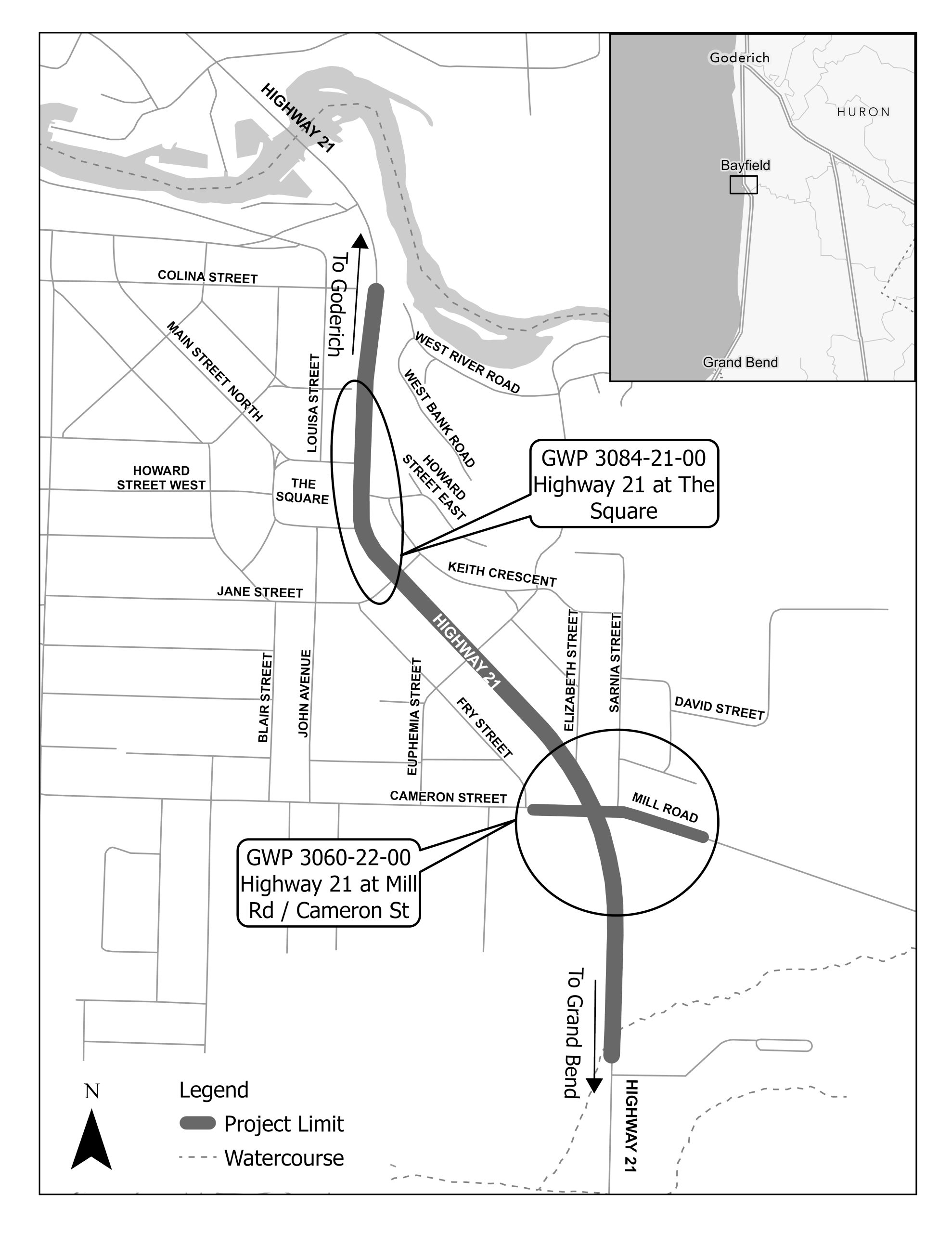
The Ontario Ministry of Transportation (MTO) has retained Parsons Inc. (‘Parsons’) to undertake the Detail Design and Class Environmental Assessment (EA) Study (the Project) for intersection improvements on Highway 21 at Mill Road / Cameron Street and ‘The Square’. The Study Area is located within the Community of Bayfield in the Municipality of Bluewater and County of Huron. The proposed improvements include the implementation of a signalized intersection at Highway 21 and Mill Road / Cameron Street, and the installation of a new pedestrian crossing along Highway 21 near The Square.
This website is to keep stakeholders and members of the public updated on the Project. This website will be continually updated to provide notification of project milestones, opportunities for public engagement and other relevant information, such as publicly available reports. The project team would be glad to address any comments, concerns or inquiries you may have regarding the Project. Please visit the Contact page to get in touch with key project staff, to submit a comment, or to be added to the project mailing list.
If you have any accessibility requirements in order to participate in this Project, please contact the Project Team through the Contact page.
Latest Updates
• Notice of Study Commencement – May 27, 2026